DJI UAV Custom GCS/Autopilot Appl Demo: WV 10/26/2016
Demo Overview
The objective of this demo activity was to develop a custom iOS Ground Control Station
(GCS) for a DJI UAV (specifically a DJI Phantom 3 advanced) with the following capabilities:
- Shall provide n autopilot capability that supports defining the flight path by selecting waypoints on a map
- Shall provide a capability to select Flight Speed
- Shall provide a capability to specify a cruise altitude
- Shall provide a capability to start the autopilot
- Shall provide a capability to stop the autopilot and allow the pilot to take over manual control of the UAV
- Shall provide a capability to send telemetry data to a UAS Traffic Management (UTM) Server
Test Flight Environment Overview
- UAV: DJI Phantom 3 Advanced
- GCS Configuration
- Apple iPad Air
- Custom GCS Application using DJI API's
- Flight path defined using GCS App and uploaded to the DJI using DJI Mission API
- Flight Speed (MPH) : 15 MPH
- Flight Altitude(Feet about Takeoff Altitude) : 250'
- Takeoff Altitude (WGS84 feet) : 750'
- River Altitude (WGS84 feet) : 600'
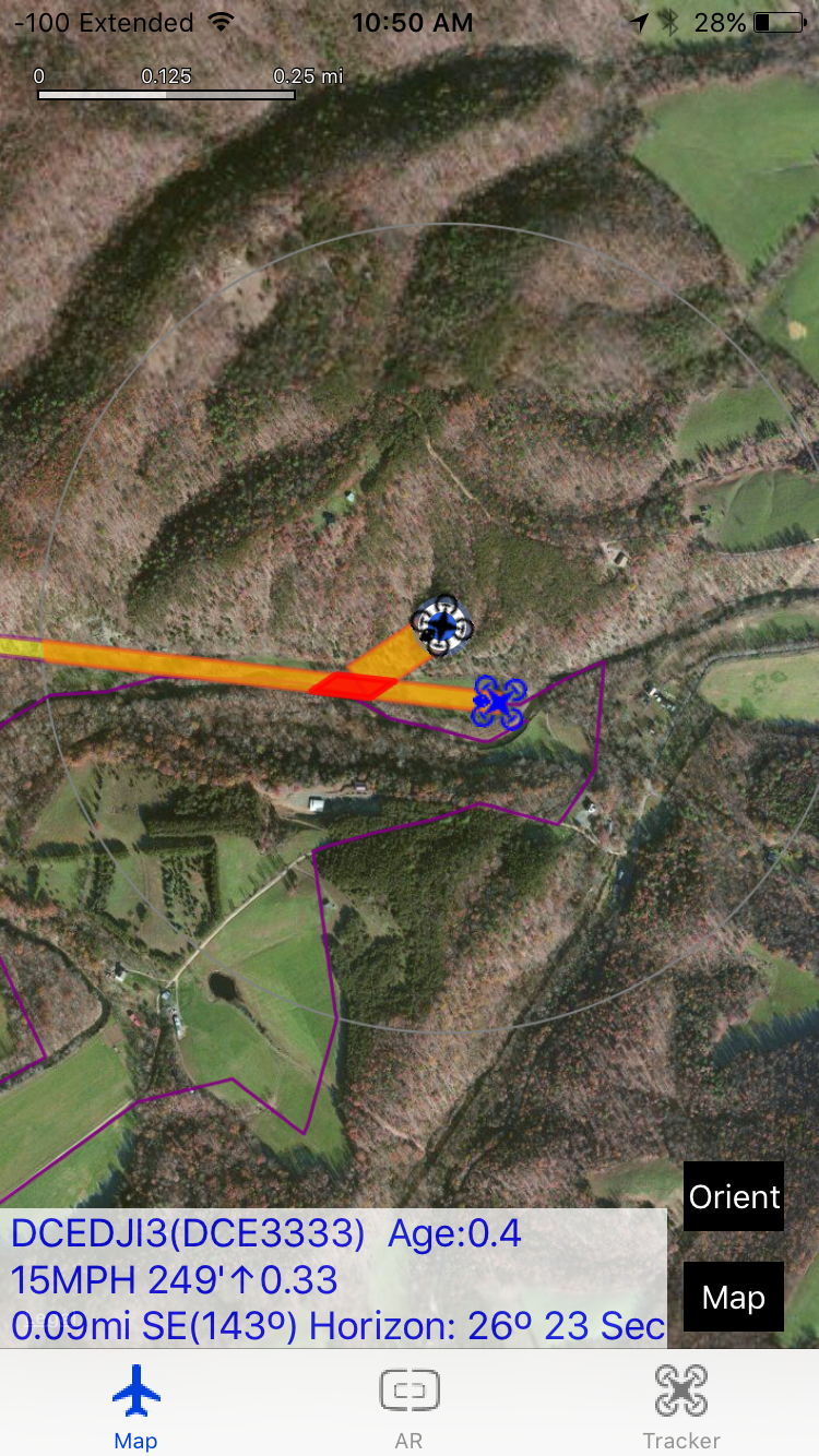
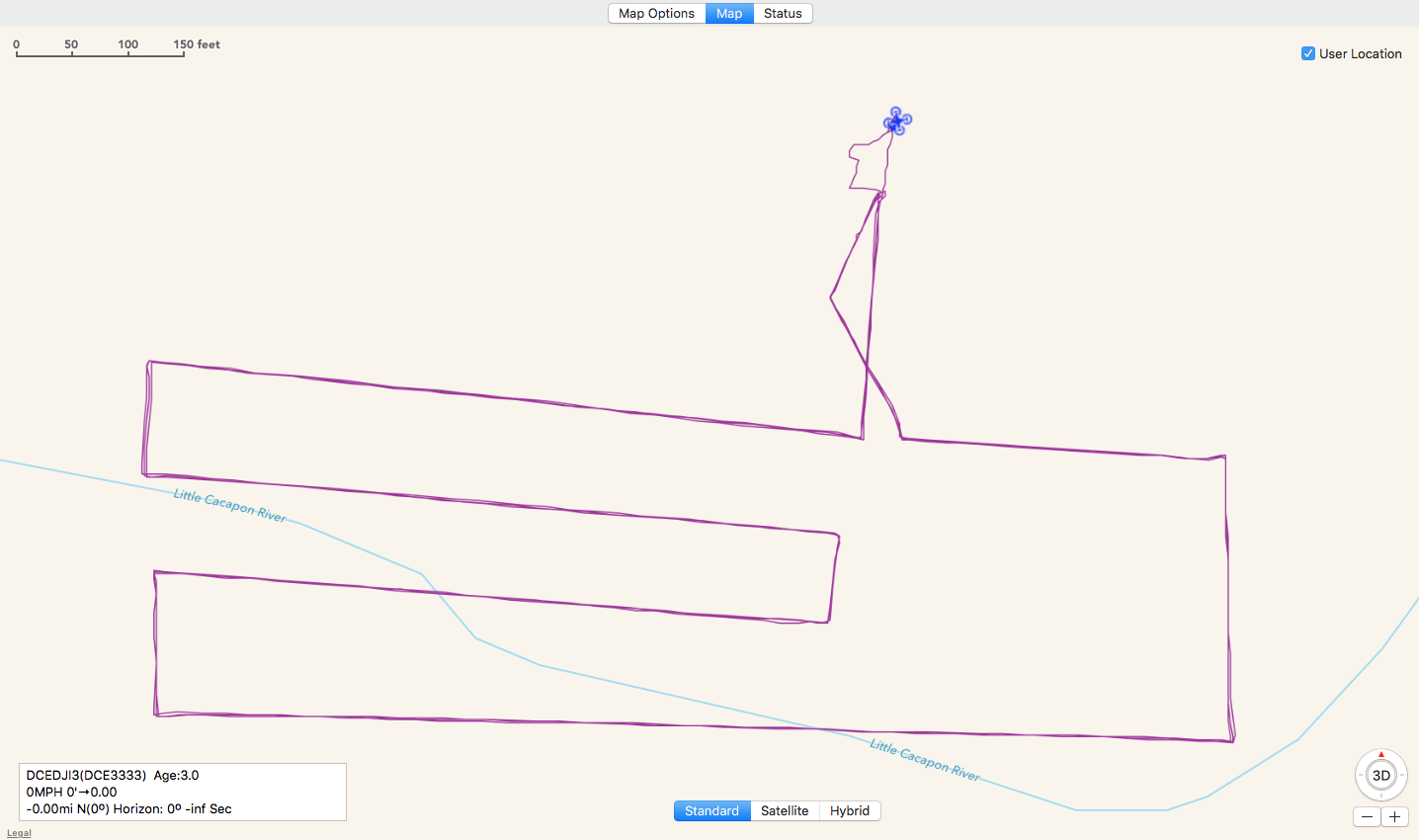
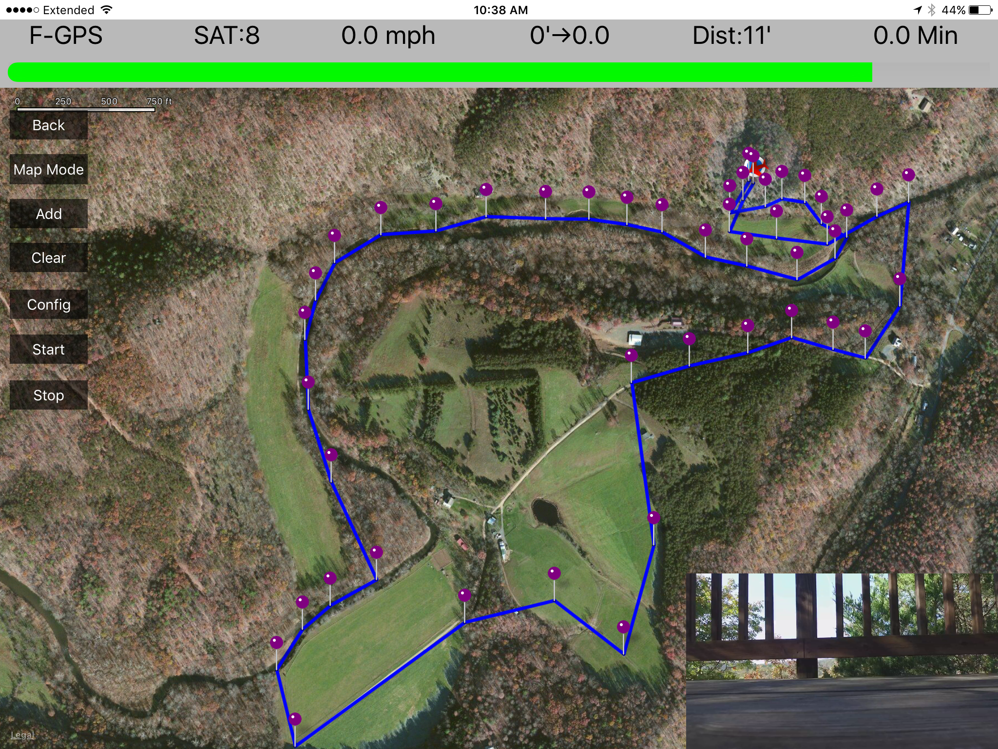
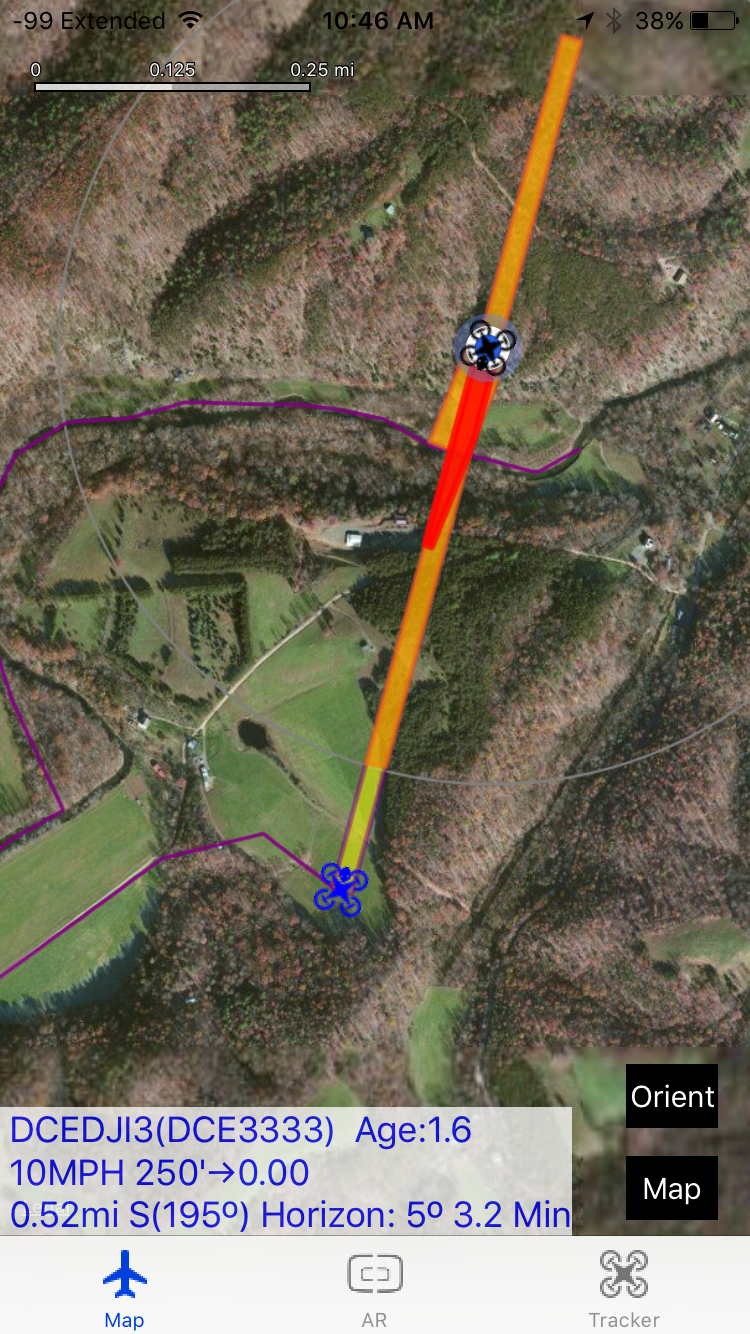
DJI Custom Ground Control Station(GCS)
The following image of the Ground Control Station (GCS) shows the flight patch that the
pilot has defined by selecting points on the map. The top of the screen shows the following information:
- DJI Flight Mode
- Number of GPS Satellites that the DJI UAV is currently using
- UAV Flight Speed
- WGS 84 Altitude, Climb/Descent Indicator, Climb/Decent Rate Feet/Minute
- Distance between the UAV and the GCS
- Slight line Flight Minutes at the current Flight speed to the location of the GCS
 ....
....
 ....
....